SaltGIS builds the dashboards, Web GIS platforms, and automation pipelines that turn raw spatial data into answers for agriculture, infrastructure, and urban planning. First production dashboard in under 6 weeks. Cuts manual effort.
Free consultation · No commitment · Reply within 24 hours
Routine Monitoring ▲
Large Scale
Real Time Alerts
Built on the open geospatial stack
Two platforms, one goal: get your team from raw spatial data to confident action faster than any spreadsheet or legacy GIS ever could.
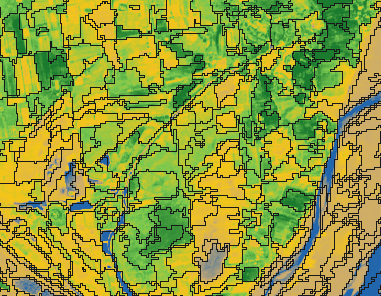
AI Field Intelligence for Agriculture
Ask your fields a question in plain language and get maps, metrics, and clear answers in seconds. NDVI, time-series, parcel health scores, and geo-pinned tasks -without a GIS specialist on staff.
We don't sell billable hours -we sell outcomes. Every engagement starts with the question: what decision will this system improve, and what is that worth to you?
Custom map-based platforms for land management, monitoring, and infrastructure -built on PostGIS, MapLibre, and Deck.gl, ready for the field and the boardroom.
Production-ready in 4–8 weeks
Operational dashboards that put KPIs on the map. Automated reports, role-based access, and exports your decision makers will actually open.
First dashboard in under 6 weeks
Satellite and sensor data ingestion, validation, and delivery -integrated with your ERP, CRM, and cloud. Stop paying people to copy-paste shapefiles.
30%+ less manual GIS work
SaltGIS develops innovative geospatial solutions that turn complex location data into actionable intelligence. From precision mapping to automation and open-source innovation, our tools are designed to help organizations manage land, resources, and infrastructure with confidence.
We build advanced GIS tools for high-accuracy mapping and spatial analysis, empowering organizations to manage land, resources, and infrastructure with confidence.
Our solutions transform raw geospatial data into clear, usable intelligence for agriculture, urban planning, environmental monitoring, and beyond.
Built with modern GIS technologies, cloud infrastructure, and scalable APIs, our applications deliver high-performance spatial analysis and mapping capabilities that grow with your business needs.
Every organization is different. We tailor our GIS platforms to fit specific workflows, datasets, and decision-making processes.
From field data collection to cloud-based analytics, we streamline geospatial workflows to save time and reduce costs.
We embrace open-source technologies and global standards, ensuring our tools are interoperable, transparent, and future-ready.
Book a free consultation and walk away with a concrete assessment of what your data can do -quick wins, a roadmap, and budget ranges. No commitment, no jargon, reply within 24 hours.
Ready to transform your spatial data? Let's discuss your geospatial needs.
sales@saltgis.eu
+37256018191
Estonia