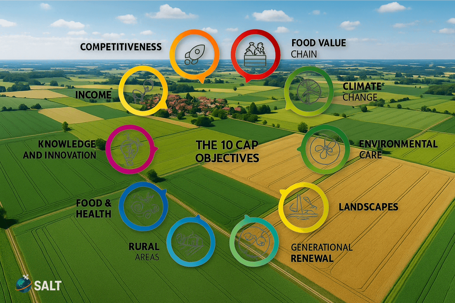
Explore how European agriculture differs from global models, why the Common Agricultural Policy (CAP) shapes every farm decision, and how GIS and remote sensing help farmers stay compliant, sustainable, and profitable.
Geospatial Experts
September 2025
Explore how NDVI, EVI, and red-edge chlorophyll indices help monitor crop and forest health from orbit, turning satellite data into actionable agricultural insights.
Geospatial Experts
September 2025